Studio Strategic Planning
Commissioner: Bergeijk Municipality, Brabant
Team: Wilma Hartog, Anne Beekhof, Bob Sastrowiardjo, Lennart de Bever, Lucas Schimmel, Mika Sardina
Scale: Regional
Location: Bergeijk, The Netherlands
Date: May, 2024
Context: The Brabantse Kempen, a rural region in Southeast Brabant, faces an increasing pressure in the need for sustainable land use, climate change and urban expansion. The area is characterized by a variety of agricultural lands, heathlands, and stream valleys. The municipality of Bergeijk is at the heart of this challenge and commissioned our team to propose strategies for maintaining biodiversity, soil health, and water quality; aspects which are critical for future climate resilience.
Objective: Focusing on sustainable land use for 2050, the project aims to develop a long-term spatial vision for the municipality of Bergeijk and the surrounding region. The goal is to balance urban growth, agricultural needs, and natural preservation while addressing key challenges like climate adaptation, biodiversity restoration, and sustainable food production. To support this vision, the project also proposes actionable short-term steps (4-10 years) for local authorities to implement as tangible kick-starters.
Outcome: The expected outcome is a comprehensive spatial vision that integrates the challenges of urbanization, climate change, and rural preservation. This will include a management summary, detailed plans, and visual maps that present a clear direction for the municipality’s sustainable future. The deliverables will guide local decision-makers in creating a more resilient, livable region, ensuring balance between nature, agriculture, and urban needs.
LOCATION
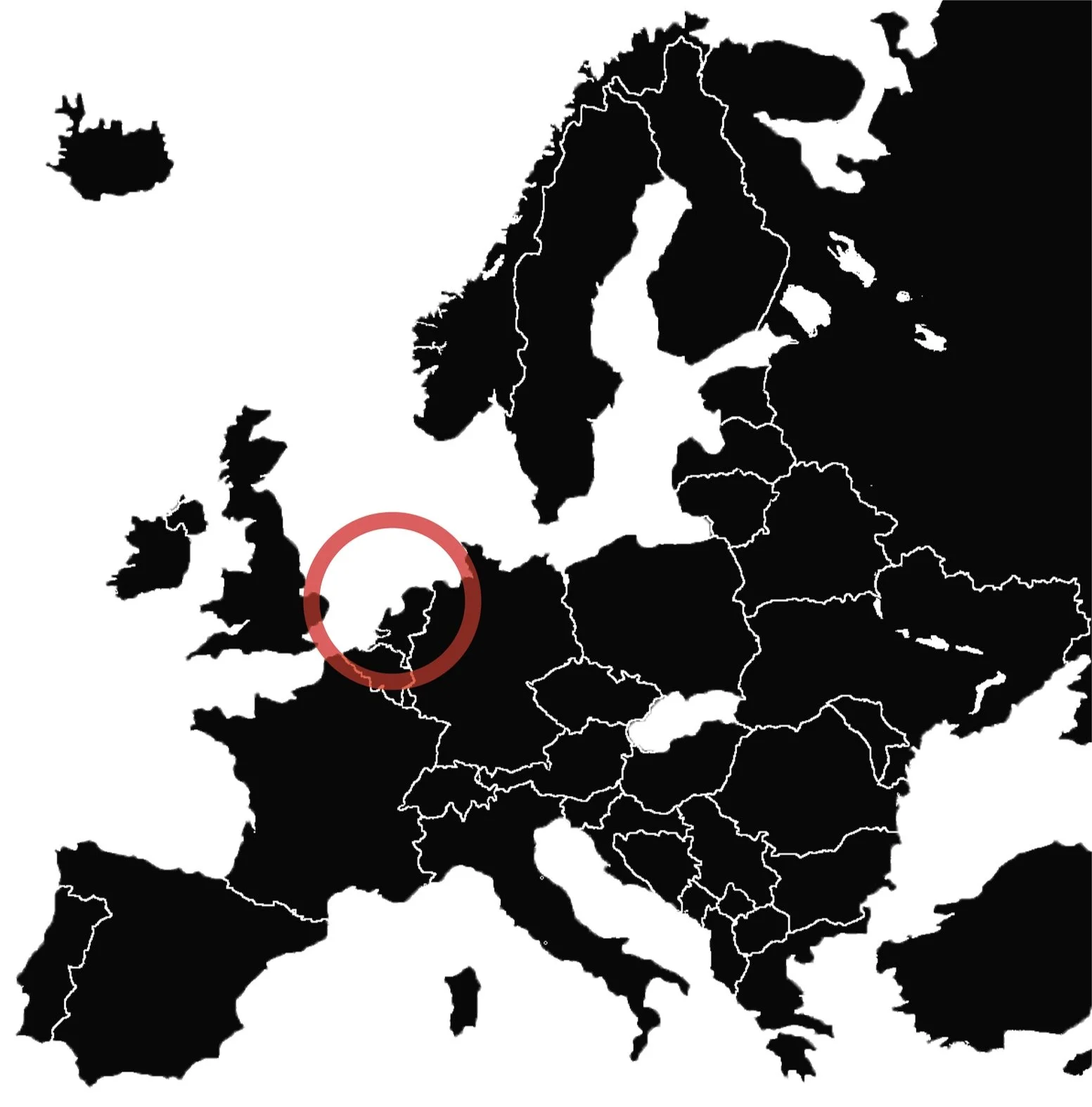
The area of interest is located in the province of Brabant, in the southeastern part of the region, known as Kempenland-West. This region, which stretches from the Belgian border to the southern part of the A58, is characterized by its rural landscape, rich in agricultural and natural areas. The focus of this project is specifically on the municipality of Bergeijk and its surrounding areas, which are representative of the broader Kempen region. Historically, the Kempenland area has been shaped by agricultural practices and industrial development, while also maintaining its distinct rural charm.
Kempenland-West enjoys efficient connections to major urban centers. The nearby A67 highway connects the region westward to Eindhoven and eastward to Venlo and Germany. Additionally, the N69 provincial road runs through Bergeijk, linking it directly with Eindhoven, offering strong ties to the Eindhoven metropolitan area. This facilitates easy access for both local residents and businesses. The Dommel River and its tributaries further contribute to the area's landscape, while offering potential for water management strategies as part of the region's climate adaptation efforts.
These spatial connections have made Kempenland-West an attractive region for both residential and economic growth. It is home to several local industries, while benefiting from the economic influence of larger corporations in Eindhoven and nearby industrial centers. Despite this, the region remains committed to preserving its rural identity and balancing growth with its agricultural and natural heritage.
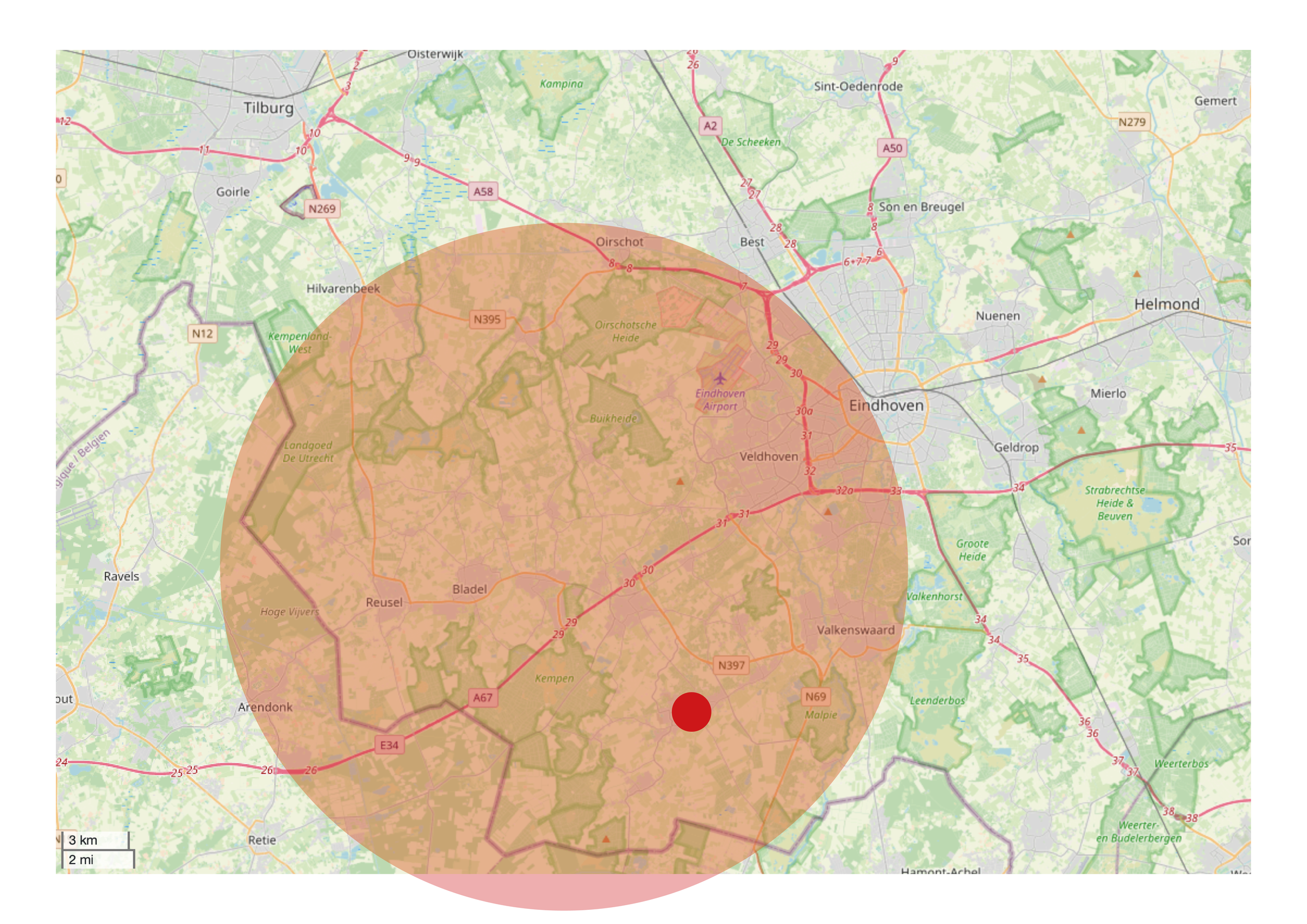
In red: Kempenland-West, red dot: Bergeijk

Kempenland-West area

Study area of project
GUIDING PRINCIPLES
Maintaining identity of rural village character
Kempenland-West has a strong history of collaboration, which has greatly contributed to its prosperity. From cultivating the land to establishing the textile industry and continuing to innovate in agriculture and manufacturing, the region has thrived without losing its rural character—a source of pride for the community. In recent decades, the area has also successfully marketed itself as a peaceful destination for recreation and vacations, maintaining its small-scale, tranquil atmosphere despite economic growth.
Residents are proud of their rural heritage and wish to preserve it, resisting pressure from the Metropolitan Region of Eindhoven. As recreation and village expansion grow, it is essential to maintain the rural identity that defines the area, ensuring it remains an attractive place to live and visit while honoring its traditional rural village identity.
Strengthening community spirit
In Kempenland-West, a strong sense of community is central to the area’s positive identity and must be reinforced. The phrase "ons kent ons" reflects this tight-knit culture, where responsibility for the neighborhood and each other is key. Increasing local participation can strengthen this bond, as residents know the area best, though new residents may feel excluded.
To foster integration, the region should continue to embrace its Brabant hospitality, ensuring that meeting places for neighbors remain, helping preserve the area's welcoming spirit.
Leading in landscape-driven developments
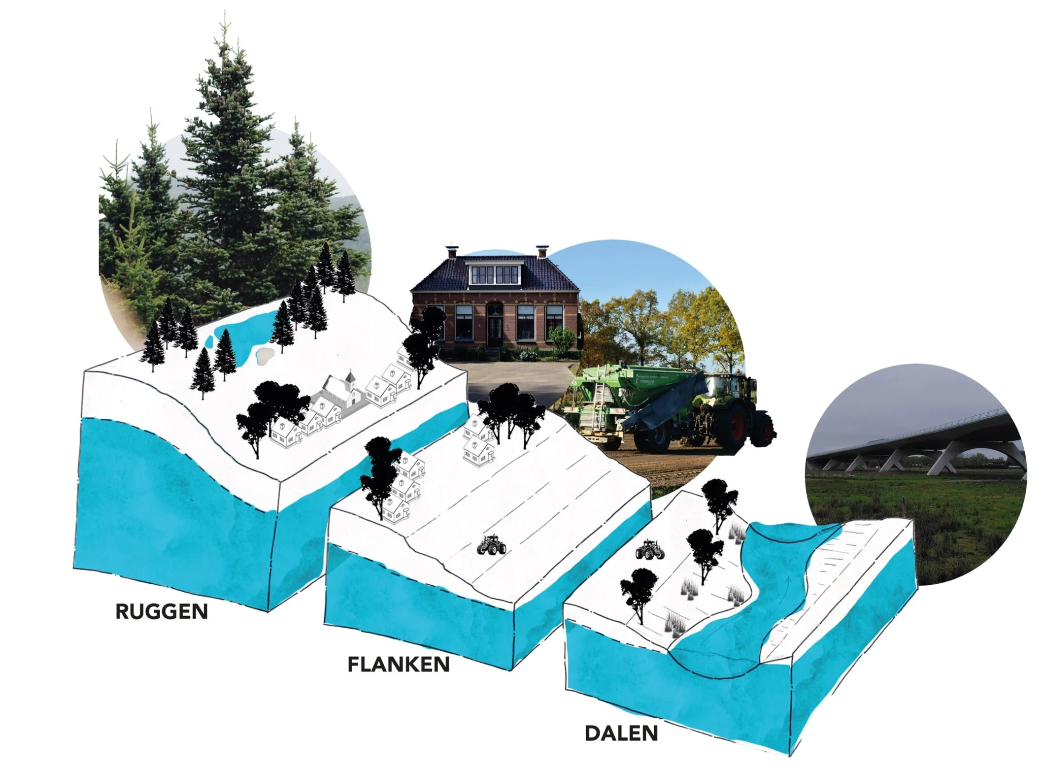
The vision proposes structuring the landscape based on the traditional landform system, where specific landscape elements only reappear in their historical locations. Using the koppen, flanken, dalen system, developments will align with the natural elevations, preserving the region's historical landscape qualities.
This approach allows the landscape to guide future developments, with higher, drier areas suited for buildings and agriculture, while lower, wetter lands will support more nature and alternative farming methods
MASTERPLAN
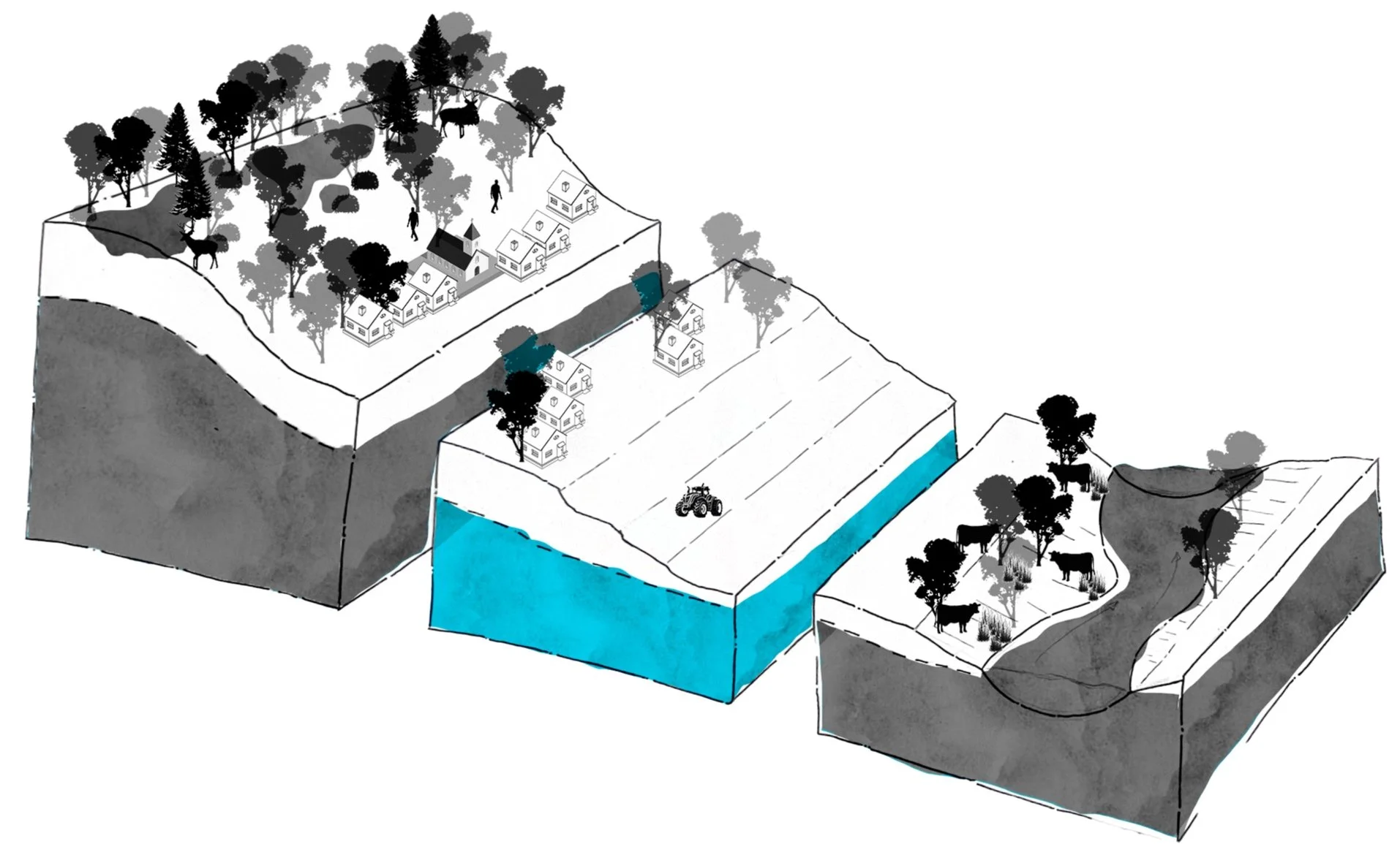
Spatial Concept: The impact of climate change varies across the landscape, with the higher peaks, called 'ruggen’, increasingly facing drought and the valleys, called 'dalen’, a challenge in terms of humidity. Each location therefore requires a different spatial interpretation. The landscape of Bergeijk in 2050 will therefore be designed according to this spatial concept of heads-flanks-valleys.
Vision: This vision emphasizes the preservation of the rural character of Bergeijk, with its alternating open and closed landscapes, the balance between nature and agriculture, and the strong sense of community that supports this environment. Both local residents and tourists appreciate the area's unique rural charm. However, this landscape is increasingly under threat due to rising demands for space, including housing development, and the global impacts of climate change.
Historically, nature has already diminished, and today, agricultural land is shrinking. Climate change will inevitably affect the Kempenland-West region, leading to rising temperatures, extreme weather, and droughts. Both nature and agriculture will suffer, impacting recreation, which depends on them. Agriculture is crucial for climate adaptation, particularly for preventing drought. Nationally, nature and agriculture are often seen as opposites, yet they share a common interest in maintaining healthy soils for crops and biodiversity.
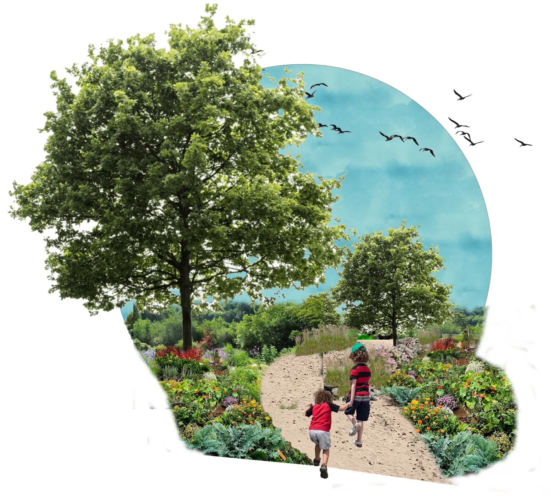
The solution lies in combining nature and agriculture through regenerative farming, which focuses on creating healthy soils to ensure resilience against climate change. By 2050, regenerative practices like food forests, meadow irrigation systems, mosaic cultivation, and paludiculture (wetland agriculture) will become essential. These methods not only protect biodiversity but also offer a solution to potential crop losses from conventional farming, which could face up to 30% yield reduction if global warming reaches 1.5 to 3 degrees Celsius above pre-industrial levels. This approach will be necessary, along with reducing food waste and avoiding competition between food and feed production.
Current situation
Possible future
DETAILED PLAN
The ridges (ruggen) are the highest points in the region, and due to the underground seepage streams, they are also the driest areas. The sandy soils allow water to quickly drain from the ridges down to the slopes (flanken) and valleys (dalen). In our vision, these elevated areas are well-suited for food forests and specialized agriculture, such as meadow irrigation systems. Additionally, we propose building homes on the high ridges, as the ground there is not as wet as in the valleys, making it more favorable for solid foundations. Although the slopes would be an even better option for building, these areas are already designated for the agricultural sector in our plan.
Street interviews and discussions with experts revealed that maintaining the village character is crucial. Therefore, residents prefer densification of existing areas rather than expansion beyond current boundaries.
Ruggen
The slopes (flanken) are the most productive lands in the region, as they are less affected by both drought and excess moisture. In our vision, these areas are designated for crop production using mosaic agriculture (mozaïekteelt), supported by a hedgerow structure that promotes nature-inclusive farming. Mosaic farming is both machine-efficient for harvesting and offers natural pest control, contributing to healthier soils. Additionally, cover crops will protect soil health during winter by preventing the land from lying fallow. The practice of undersowing will further enhance crop yields. For instance, clover can grow beneath corn, with clover fixing nitrogen and enriching the soil, which boosts corn growth. This results in higher corn yields while also allowing the clover to be harvested—a double benefit.
Perennial plants, such as hedgerow structures (houtwallen), bring multiple advantages to mosaic farming. These hedgerows improve yields by serving as windbreaks for crops and animals, providing shade for livestock, and fostering extensive fungal networks that can draw water from deeper layers, ultimately boosting crop productivity.
Flanken
In this landscape vision, the stream valleys (beekdalen) are primarily used for extensive agriculture and nature, serving both recreational and productive purposes. These natural valleys form a robust ecological corridor that, by 2050, retains significant amounts of water, preventing drought and protecting the flora and fauna that thrive in these wet conditions. Additionally, the stream valleys act as climate buffers, moderating temperatures in the region. Drought has become a challenge, especially during summer when the Keersop, a tributary of the Dommel, nearly runs dry. To combat this, all streams will be re-meandered by 2050.
The wet characteristics of the stream valley system not only benefit the local flora and fauna but also serve as a source for building materials and livestock feed. These ecosystem services are made possible through wet cultivation, known as paludiculture. This innovative form of agriculture is well-suited for wet areas like peatlands and, in this case, the moist stream valleys.
Dalen
FULL DOCUMENTS
On the basis of a spatial analysis - with trends and scenarios - and guiding principles, a vision was drawn, along with associated strategies with the approach needed to achieve a liveable and rural Bergeijk in 2050.
Poster used during the final presentation with the commissioner to convey our message in one poster.


